Thursday, November 10, 2011

IMTUF 100 Recon: The Crestline Trail

Crestline Trail: the premier mountain run in the McCall area.  Once more in 2011, because July will not come for a looooooooong time.  We began our 20 miler on Lick Creek Road by climbing to Fall Creek Saddle.  We then traversed along the southern portion of the Crestline Trail, passing Blackwell Lake, joining the Crestline proper for its alpine journey northward.  We departed the Crestline Trail at the junction with the Box lake Trail, following it and the Black Lee Creek drainage back to the truck.  4500' of gain and 3-6 inches of snow the whole way: PERFECT!


Slickrock.  A 1000'+ granite monolith stands tall and proud over Lick Creek Road.

B climbs the steep and icy Fall Creek Trail.

Rewarded for our efforts, the view from Fall Creek Summit is amazing.  The Fitsum Peaks in the background.

Looking north at the Northern Crestline Trail and points beyond. 

B descends from Fall Creek Saddle, heading for Blackwell Lake.  Payette Lake and the town of McCall are in the background here.

Wolfpack likes the Crestline Trail too.  Speaking of wolves, B and I just saw two more giants today.  It is really hard to beat McCall if you love wildlife.
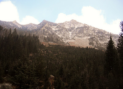
B moves through a high alpine meadow below the beautiful Box Peak 7941'.
Climbing higher toward the ridge crest.  Pearly white granite looks like the Sierra Nevadas of California.

B and tree from Poltergeist.

Pausing to take in the view at the Crestline Trail highpoint- just over 8K'.  Beaverdam Peak (8653') in the background.

Once off the saddle of the Crestline, we descend into an icy alpine north face.   A 1000' drop brings us to the shores of Box Lake.

Running the south shore of Box Lake.  One of the true jewels of the McCall Backcountry.

Climbing one more time to Box Lake Pass (7600').

Things are getting blurry as the hours drag on.  Or, perhaps I dropped the camera in the snow?

From Box Lake Pass it is all downhill following Black Lee Creek 4 miles back to the truck.  Not the easiest 4 miles you ever ran downhill.  Check your knees before tackling this one.


Tuesday, November 8, 2011

Running Brundage Ski Resort

A glorious last autumn hurrah on my bread and butter staple run.  My 13th Brundage running summit of the year, with many more on skins and hundreds more via chairlift.  A perfect training run that never gets boring.   

A solid 6 miles climb gains 1800+' on the Elk Trail. Less than four miles back to the lodge on the South Lodge Lane (aka Cat Track).  B ran all the way to the top today, for her first "no-walk" ascent. Three or four inches of fresh POW made the climbing tricky and physical. In a few weeks we will be skinning and skiiing these slopes- until late June.


On the 8 mile drive to Brundage from McCall, you pass a small roadside park affording this incredible view of Payette Lake and the Crestline Trail.  That skyline is the centerpiece of the Wild Idaho 100.


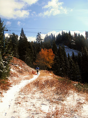
B about a mile into her Brundage climb.

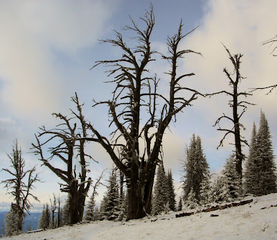
These trees live tough lives.  Withered and gnarly.

The view west from Brundage's summit of the Crestline Trail and the Lick Creek Range behind.

B nears the top as Granite Mountain looks on.

B triumphant on top.

Friday, November 4, 2011

More IMTUF 100 Recon: Ruby Meadows

A typical mountain day.  Begin with a good cup of coffee.  Gas up the chainsaw and head for the hills.  Cut a truckload of wood.  Then hit the trailhead.  Today, it was the Ruby Meadows Trail near Burgdorf.  This classic will surely be part of the Wild Idaho 100 race next fall.  A driving snow only added to its character.  This may be our last day before the roads to the high peaks close.  If so, it was a great year of adventures.


B crosses the beautiful Ruby Meadows.


Let it snow.

Muleys enjoying the snow.  Payette Lake backdrop.

IMTUF 100 Recon: A Day on Bear Pete Mountain

B and I headed up to Burgdorf for another day of fun in the peaks.  We climbed up Nethker Creek to the shoulder of the gigantic Bear Pete Mountain.  Lots of great views and cold, windy weather greeted us on top.  Winter is clearly on its way.  A soothing soak in the World Famous Burgdorf Hotsprings finished off the day.

Climbing Nethker Creek Trail.

Wolverine or Badger?  The tracks clearly show 5 clawed toes- so not a bear, lion or wolf.  I sent the pics to the Idaho Fish and Game, who are doing a wolverine study.  We'll she what they say.

Our summit for the day on the ridge.  Black Tip, Bruin , Hard Butte and a myriad of other peaks to the Southwest.

B motors along the ridge with views of the Salmon River breaks in the background.

Ahhh Burgdorf.  100+F in the water and 20F out of it.

Upper Payette Lake with the 20 Mile drainage (Left) and Storm Peak (Right) visable.

Payette Lake at Dusk with Osprey Point of Ponderosa State Park.  Lots of Tamaracks showing golden glory.

Post run hydration is critical.  Robie is keen on this.

Wednesday, November 2, 2011

More IMTUF 100 Recon: Victor, Loon and Twenty Mile Creek Megaloop


A cold and blustery day at the office- a full 8 hour, 35 mile day of IMTUF100 research.  The first truly cold snap of the year with alpine temps below 20F.  Victor Creek is a superb trail cresting the 8K' Diamond Ridge with views of the stunning Diamond Rock.  Loon Lake was beautiful as ever, but the Loon Creek drainage was an unending bushwhack.  Definitely needs some TLC from the forest service (Tender Loving Chainsaws).  That 11 mile stretch took almost 4 hours.  I was soaked to the bone after repeated crossings and one slip and fall. Twenty Mile Creek was awesome as always- fast footing, big views and wildlife.

Victor Creek Trail #117. Looking east toward the North Fork of the Payette River, Burgdorf and its surrounding peaks. 

Looking West from Diamond Ridge at Victor (L) and Storm (R) Peaks.


Diamond Rock.  Looks prime for some first ascents on golden granite.

Victor Creek Trail heading toward Loon Lake.  This is what I love about Idaho- you move between burned areas, Alpine ridges, to deep dark old growth forests.  Never gets boring.

Beginning the slog up Look Creek.  Looking toward the big alpine peaks of North and South Loon .

Higher into Loon Creek, meadows abound.

The stunning west faces of the Loon Peaks.

Twenty Mile Creek elk.  Two young cows.

The last traces of light capture the peaks I have traversed all day.